Noorder IJstad
On the northern banks of the River IJ, a new Amsterdam has been envisaged by the municipality. Noorder IJstad is an alternative urbanisation vision for this area, a large-scale landscaping plan designed by BOOM Landscape. The plan involves sustainability and circularity goals, as well as a vibrant waterfront on the river and Noorder IJplas lake. This new district built from scratch would offer a lot of space – for living, but also for the creative and artisanal industries that historically reside in Amsterdam North. This ‘productive’ use of space would furthermore be sustainable thanks to an impressive network of greenery and water. The new district is well-connected to the IJ and to the open landscape of the north-east (Waterlandscheg), but it should also be the link that connects surrounding neighbourhoods.
Counteracting climate change
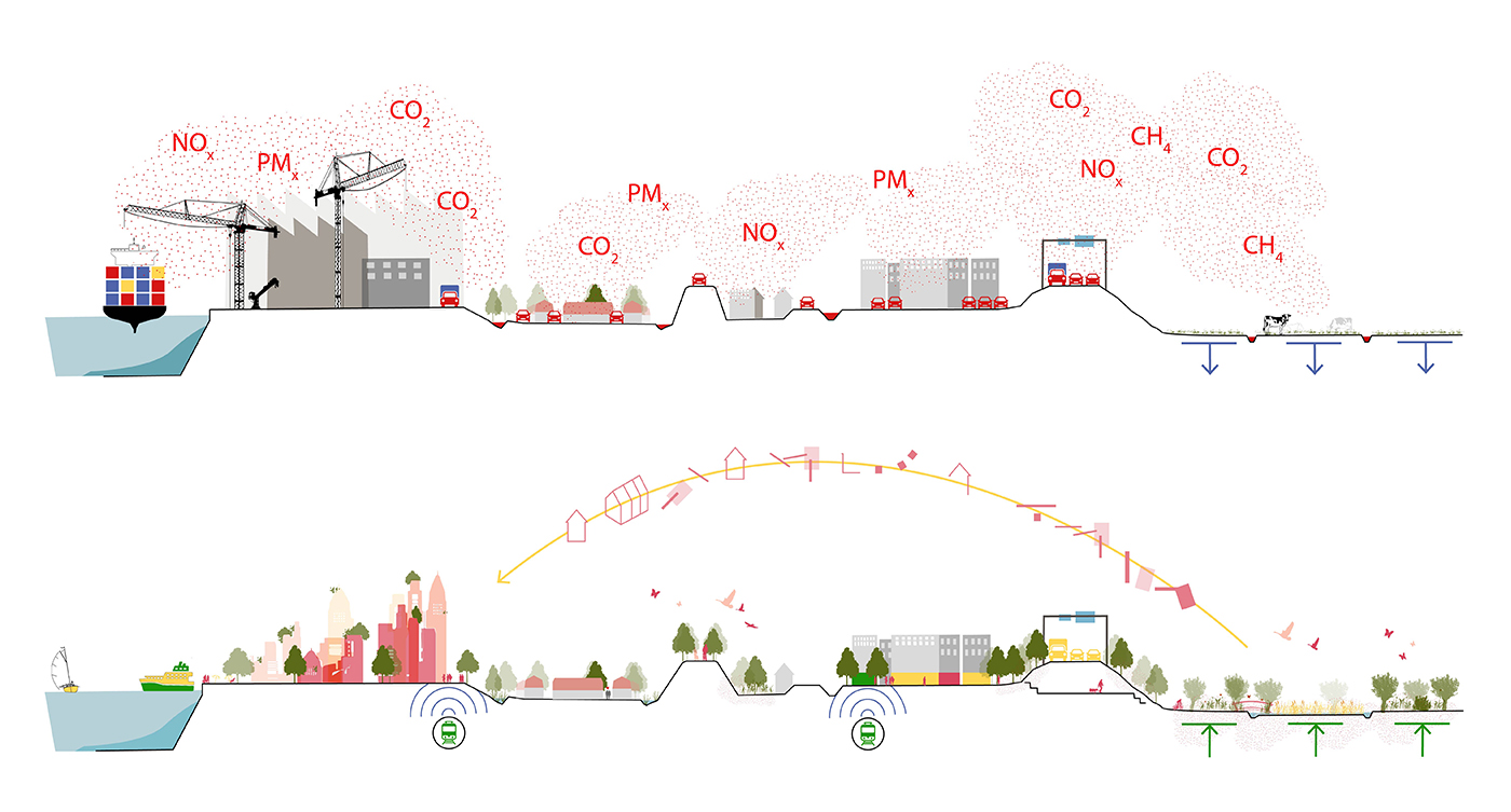
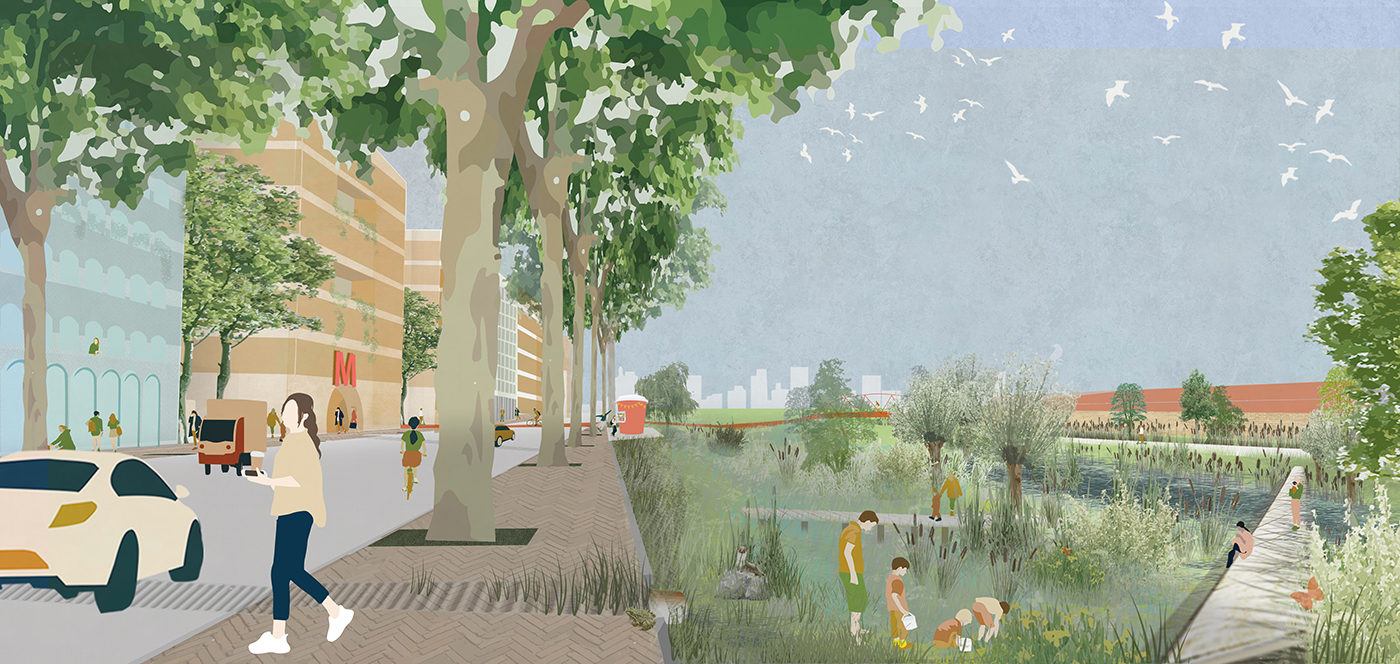
The vision: Noorder IJstad is a modern, climate-neutral city full of green space and smart water systems. At every level the city is framed and supported by greenery: a continuous structure that links facades to parks and landscapes beyond. Such a system reduces urban heat islands and is good for bio-diversity. A network of wadis (pools/ditches that filter, store, and clean water) cools urban spaces and keeps the city clean. There are fewer cars with the availability of excellent public transport connections, including a new ferry and metro lines.
The Waterlandscheg landscape beyond the borders of the district can also sustain economic productivity in an environmentally suitable way. Currently the area is predominantly used for raising cattle and it generates high CO2 emissions on account of peat oxidation. To put a stop to this, the land would be made wetter with paludiculture. This wet agriculture is ideal for cultivating bio-based buildings materials, making the area economically productive while in turn creating an attractive landscape for people and wildlife.
Connecting Amsterdam North
Large parts of Amsterdam-Noord are poorly connected – to each other, to the rest of the city, and to the surrounding landscape. So it was important to design good interconnections for Noorder IJstad. The new Noordas, ‘North Axis’ (a counterpart to the southern Amsterdam Zuidas), has a metro station, is the most significant access point for cars, and connects all the neighbourhoods on the banks of the IJ. At the halfway point on the urban periphery is the main boulevard where slow traffic can access the (mostly car-free) interior. Green lines connect the centre to the countryside, and new cycle routes make for a pleasant and efficient connection to the town of Zaandam.
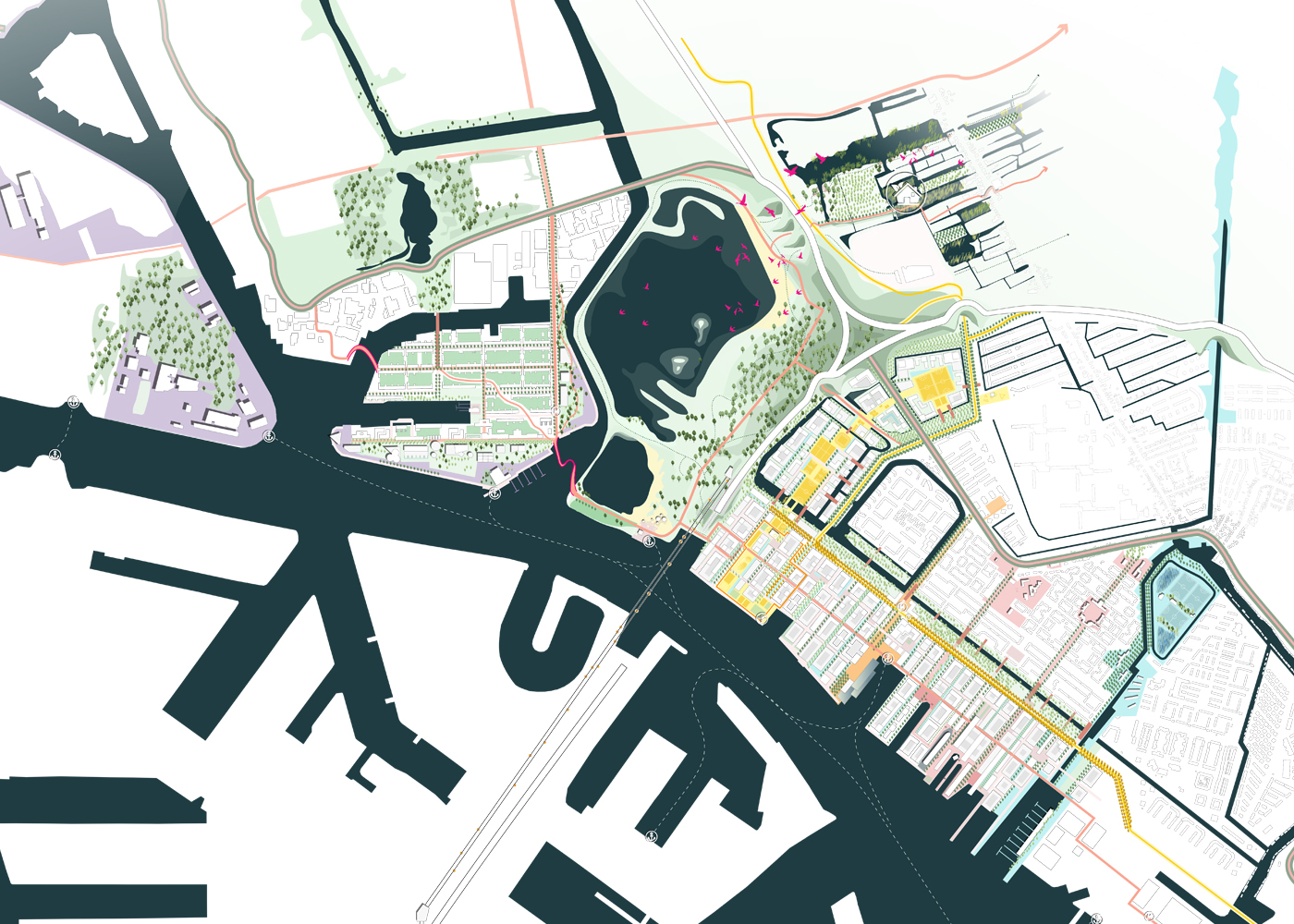
Reinforcing existing lines
From shipping docks to breeding grounds (both creative and natural), the banks of the IJ host a huge variety of life, sectioned off by infrastructure, waterways and greenery. In our plan these lines have been transformed into routes that naturally connect all the different environments. Each line has its own theme and extends out to the countryside. ‘Industrial heritage’ is one such theme: a line that takes you past former factories and old warehouses, and connects you to Zaandam, known for its 17th-century milling industries. Another line links up with sports fields and the recreational potential of the IJ.
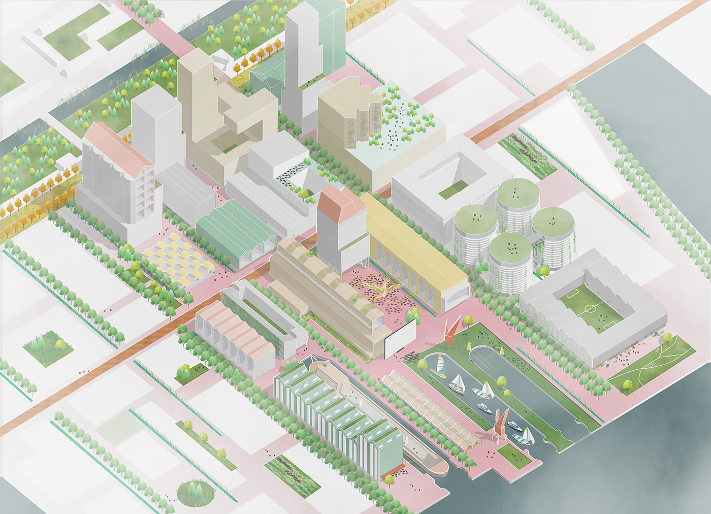
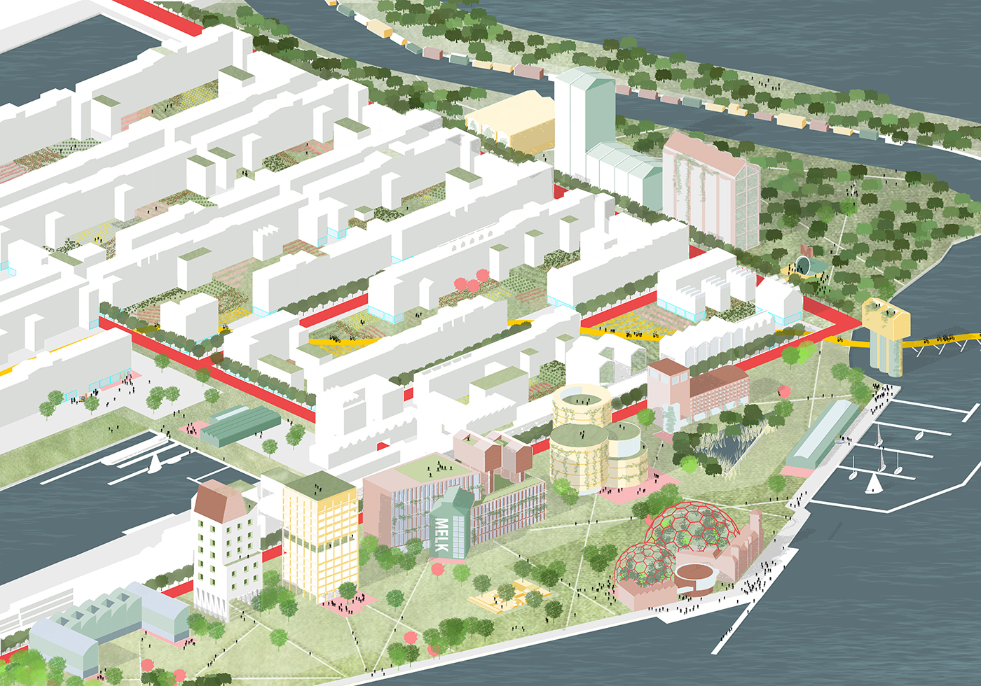
Noordas urbanism and a lively waterfront
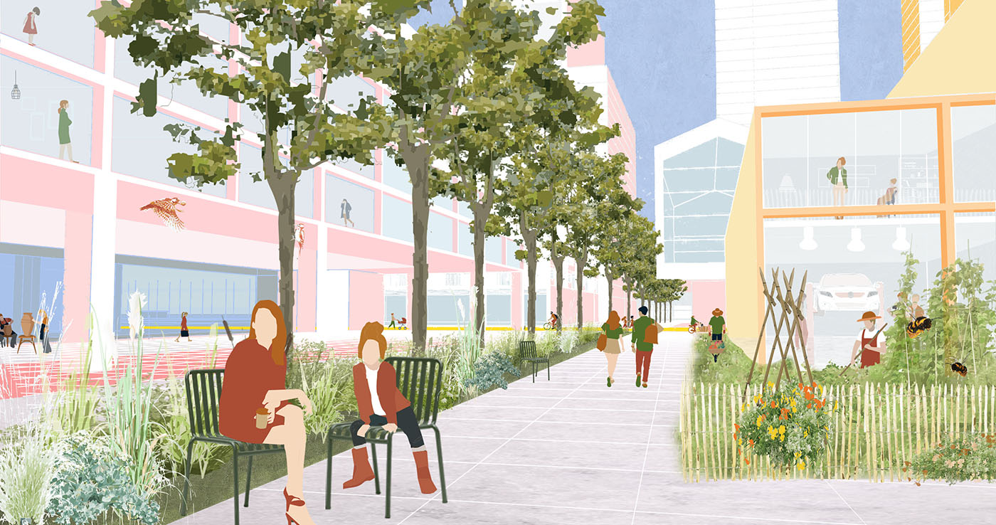
The North Axis is designed to be a transitional zone between the new district and the older ‘satellite’ garden cities. The wide Cornelis Douwesweg avenue is a city street where pedestrians access the metro. It is an urban environment full of amenities to benefit all of Amsterdam-Noord. A water purification zone flows alongside the street and connects with all the wadis dispersed throughout the district. Bridges connect the new urban environment with the existing garden cities.
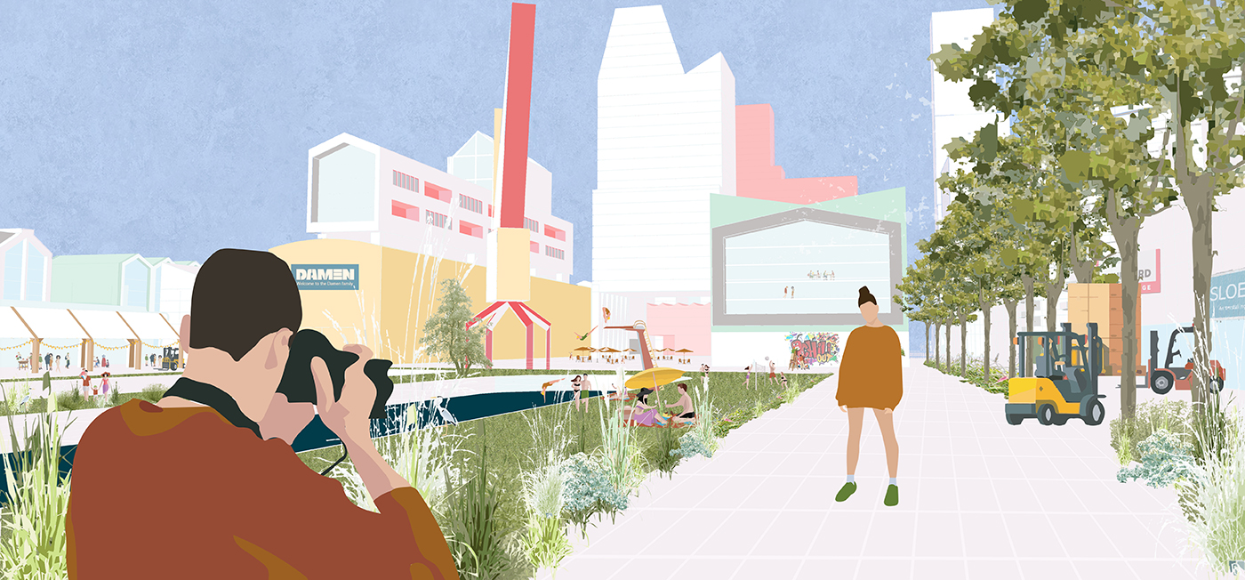
The building heights scale down towards the river so that all residences have a good view of the water. Throughout Noorder IJstad, free spaces for countless kinds of activities have been integrated. Creative entrepreneurship can thrive, as can small-scale events and leisure/recreational opportunities. These free spaces are part of a deliberate structure that lets the city be explored by meandering. On the riverbank itself there is a park with a few striking buildings – the eye-catchers of the area.
Living, working and enjoying green space close to home
Residential, recreational, and economic spaces are combined in an agreeable way in the largely car-free city centre. Much thought has gone into creating green spaces close to home, for example in the form of shared vegetable gardens, workshop spaces for all, generous forecourts to buildings, and rooftop gardens for residents.
Achtersluispolder
The design gives the Achtersluispolder area (heading towards Zaanstad) a border of parkland and a handful of striking high-rises that reference the area’s previous industrial and informal character. Within the green circumference, a city grid is enriched by inner courtyards for gardens. A major cycle route runs straight through this district to connect the eastern edge of Noorder IJplas with Zaandam.
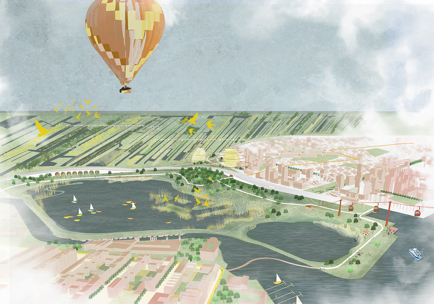
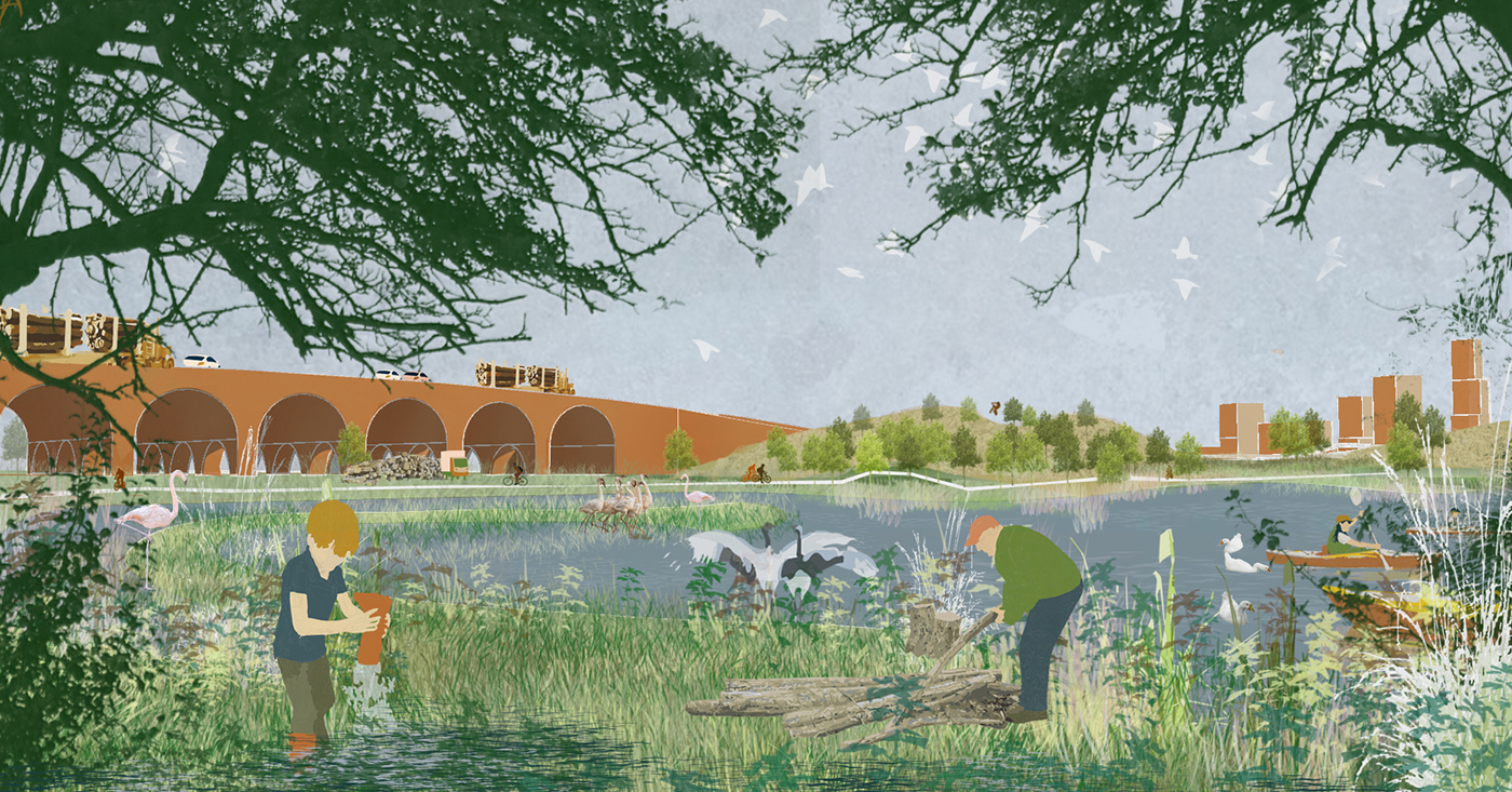
Waterpark Noorder IJplas: gateway to the open landscape beyond
Between Achtersluispolder and Noorder IJstad a water park can be established on the lake: an eco-park of international standing. Apart from being the central juncture that connects the surrounding districts, it is also a recreational gateway: a stepping stone towards the Waterlandscheg hinterland. And in its position, the lake/park is an important ecological hub that links up all the various urban green structures. The nature in and around the lake can develop naturally and therefore acquire a wilder feel. For city dwellers it is also a place to escape the hustle and bustle of urban life and enjoy walks, go swimming, ride a horse, or go motocrossing in the mud.